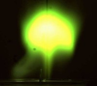
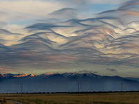
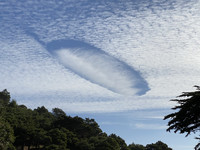
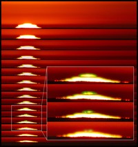
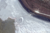
Morning Glory Cloud
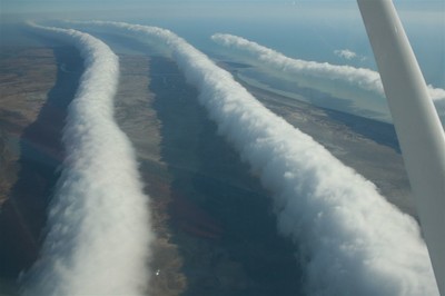
ADDPMP745A morning glory cloud is a roll cloud, or arcus cloud, that can be up to 1,000km (620 miles) long, 1–2km (0.62– 1.24 miles) high and often only 100–200m (330–660ft) above the ground. The cloud often travels at the rate of 10–20m (32.8–65.6ft) per second. There can be up to ten consecutive roll clouds.
The morning glory is often accompanied by sudden wind squalls, intense low-level wind shear, a rapid increase in the vertical displacement of air parcels and a sharp pressure jump at the surface. Showers or thunderstorms may develop in the cloud’s wake. At the front of the cloud, there is a strong vertical motion that transports air up through the cloud and creates a rolling appearance while the air in the middle and rear of the cloud becomes turbulent and sinks. The cloud quickly dissipates over land where the air is drier.
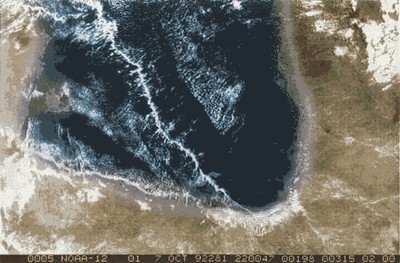
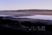
The southern part of the Gulf of Carpentaria in Northern Australia is the only known location where a morning glory cloud can be predicted and observed regularly due to the configuration of land and sea in the area. However, it can be occasionally observed in different locations around the world.