Klencke Atlas
ADDPMP556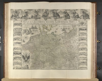
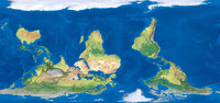
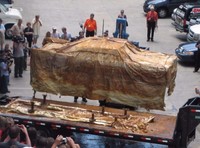
The Klencke Atlas, first published in 1660, is one of the world’s largest atlases.[1] Originating in The Netherlands, it is 1.75 metres (5 ft 9 in) tall by 1.9 metres (6 ft 3 in) wide when open, and so heavy the British Library needed six people to carry it.
Klencke Atlas is a singular work; no other copies were created. It is a world atlas made up of 41 copperplate wall maps that remain in exceptionally good condition. The maps were intended to be removed and displayed on the wall. The maps are of the continents and assorted European states and it was said to encompass all the geographical knowledge of the time. Dutch Prince John Maurice of Nassau is credited with its creation, and it contains engravings by artists Blaeu and Hondius and others.
It was presented by a consortium of Dutch sugar merchants, represented by Professor Johannes Klencke, to King Charles II of England in 1660 to mark the occasion of his Restoration to the throne. The consortium hoped to gain favourable trade agreements with Britain for their sugar plantations in Brazil. Johannes Klencke was the son of a Dutch merchant family. Charles, a map enthusiast, kept it in the ‘Cabinet and Closset of rarities’ in Whitehall.